Carved directly across the storm-exposed archipelago of Hustadvika on Norway's northwestern coast, the Atlantic Ocean Road (Norwegian: Atlanterhavsvegen) forms an 8.3-kilometre section of County Road 64. Connecting the island municipality of Averøy with the mainland peninsula of Eide, this highway leapfrogs across low skerries, rocky islets, and ocean channels via an interconnected sequence of eight cantilever bridges, viaducts, and raised causeways.
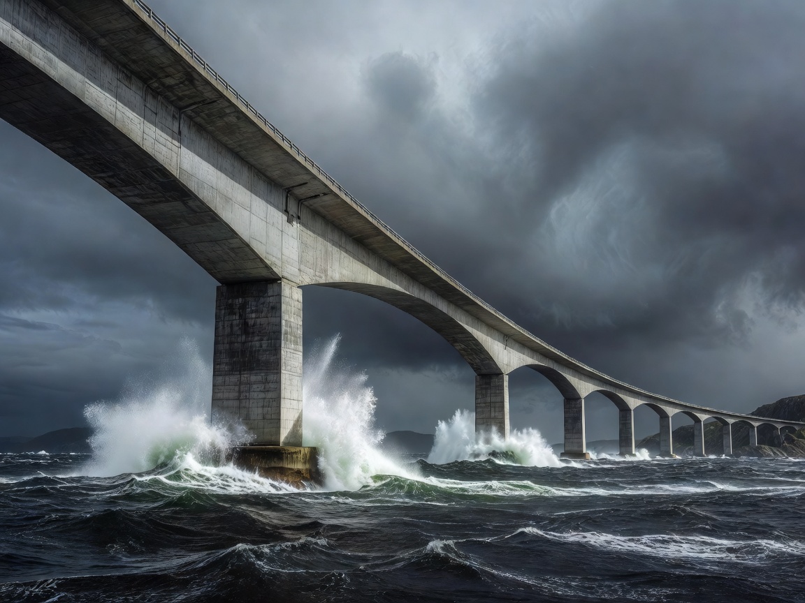
Engineering Feats: Storseisundet Bridge
The centerpiece of the route is the Storseisundet Bridge, a 260-metre-long cantilever structure rising 23 metres above mean high tide to allow commercial fishing vessels unhindered passage between the open sea and Lauvøyfjorden. Due to the asymmetric curvature engineered to bridge two misaligned islets, the bridge produces a distinctive optical illusion from certain landward angles, appearing to crest abruptly and disappear into the open sky.
Construction of the roadway commenced in 1983 and required six years to complete, enduring twelve recorded Atlantic hurricane-force storms during the engineering phase before opening to vehicle traffic in July 1989. In 2005, the structure was designated the "Norwegian Construction of the Century."
Key Observation Points Along County Road 64
- Eldhusøya: The largest island facility along the route, Eldhusøya features an elevated circular walking path constructed from weather-resistant composite grating. Designed by Ghilardi+Hellsten Arkitekter, this 700-metre boardwalk allows visitors to traverse delicate coastal wetlands without disrupting nesting seabird colonies.
- Askevågen Lookout: A compact concrete-and-glass viewing platform situated at the terminus of a breakwater, offering 360-degree exposure to the open waters of Hustadvika and the surrounding archipelago.
- Geitøya: A rocky outcrop providing designated parking and the seasonal passenger ferry departure dock for the historic 14th-century fishing community of Håholmen.
Coastal Weather Hazards
The Hustadvika ocean expanse is notorious among mariners as one of Norway’s most treacherous shallow-water coastal reaches. During autumn and winter gale-force storms, ocean swells regularly crest the low causeways, sending sea spray and foam across vehicle windscreens. Road authorities close the causeway during extreme weather alerts.
Comparison with Other Norwegian Scenic Routes
| Scenic Route | Terrain Type | Length | Highlight Feature |
|---|---|---|---|
| Atlantic Ocean Road (Atlanterhavsvegen) | Low-lying ocean skerries and open sea | 8.3 km (core) / 36 km (total) | Curved cantilever bridges and ocean surge |
| Trollstigen (The Troll's Ladder) | Vertical mountain pass & glacial cirque | 106 km | 11 hairpin switchbacks & Stigfossen falls |
| Helgeland Coast (Kystriksveien) | Deep coastal fjords and island ferries | 433 km | Torghatten mountain with hole; Arctic Circle crossing |
| Hardanger Scenic Route | Fruit orchards and inner fjord shores | 158 km | Vøringsfossen 182-metre step waterfall |
Pros and Cons of Driving the Route
Unique Highlights
Unmatched photographic opportunities of maritime architecture integrated into wild oceanic geology. The route is entirely toll-free and easily integrated into a wider loop connecting Kristiansund, Molde, and Ålesund.
Trip Considerations
The core bridge corridor is brief: driving across without stopping takes under ten minutes. On calm summer days, the visual impact is peaceful rather than dramatic; catching the famous wave-crashing storm aesthetic requires visiting during volatile autumn conditions.
Suggested 3-Day Northwestern Driving Itinerary
- Day 1 (Ålesund to Molde): Explore the Art Nouveau architecture of Ålesund, traverse the submarine tunnels to Godøya lighthouse, and take the Vestnes-Molde car ferry across the panoramic Romsdalsfjord.
- Day 2 (Molde to Kristiansund via Atlantic Road): Drive north via Elnesvågen to Bud, visit the Ergan coastal fortress, and spend several hours traversing the Atlantic Ocean Road before reaching Kristiansund, known for historic clipfish (bacalao) production.
- Day 3 (Kristiansund to Åndalsnes): Travel south through the Romsdal valley, tracing the Rauma river beneath the sheer 1,000-metre vertical face of Trollveggen (The Troll Wall).